8192 × 4096 — JPEG 24.2 MB
Hinzugefügt zu 360 Panoramas — Vor 4 Tagen — 18 Aufrufe
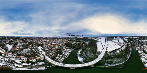
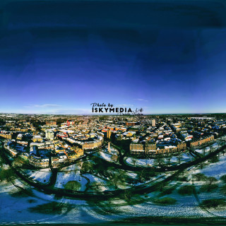
Aerial panoramic view of a snow-covered town beside a river, featuring a curved highway bridge and railway line. The sky is partly cloudy in Knaresborough, UK.
Photo Details
-
Resolution
8192 × 4096
-
File Size
24.2 MB
-
Format
JPEG
-
Location
GPS coordinates available
View map
-
Camera Make
DJI
-
Camera Model
FC3582
-
Exposure Time
1/1250s
-
Aperture
ƒ/17/10
-
ISO
200
-
Focal Length
168/25 mm
-
Color Space
sRGB
-
Contrast
Normal
-
Date Time Digitized
2025-01-08 14:29:12
-
Date Time Original
2025-01-08 14:29:12
-
Digital Zoom Ratio
1/1
-
Exif Version
0230
-
Exposure Bias Value
7/10
-
Exposure Mode
Manual
-
Exposure Program
Manual
-
Flash
No Flash
-
Gain Control
None
-
Light Source
Cloudy
-
Max Aperture Value
153/100
-
Metering Mode
Average
-
Orientation
Horizontal (normal)
-
Resolution Unit
inches
-
Saturation
Normal
-
Scene Capture Type
Standard
-
Sharpness
Normal
-
Software
Luminar Neo
-
White Balance
Auto
-
X Resolution
72/1 dpi
-
Y Resolution
72/1 dpi
-
Latitude
54.00856944
-
Longitude
-1.47176111
-
Altitude
230671/1000
Open larger map