2560 × 1438 — JPEG 507.8 KB
Added to Yorkshire — 6 days ago — 14 views
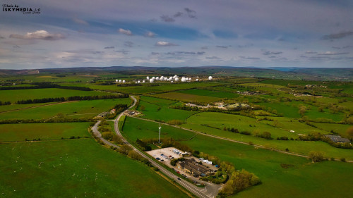
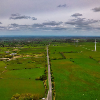
Aerial view of a rural landscape with a road winding through green fields, leading towards a cluster of large white satellite dishes in the distance.
Photo Details
-
Resolution
2560 × 1438
-
File Size
507.8 KB
-
Format
JPEG
-
Location
GPS coordinates available
View map
-
Camera Make
DJI
-
Camera Model
FC3411
-
Exposure Time
1/500s
-
Aperture
ƒ/14/5
-
ISO
100
-
Focal Length
419/50 mm
-
Color Space
sRGB
-
Contrast
Normal
-
Date Time Digitized
2024-04-21 13:13:34
-
Date Time Original
2024-04-21 13:13:34
-
Digital Zoom Ratio
1/1
-
Exif Version
0230
-
Exposure Bias Value
-17/10
-
Exposure Mode
Manual
-
Exposure Program
Manual
-
Flash
No Flash
-
Gain Control
None
-
Light Source
Cloudy
-
Max Aperture Value
297/100
-
Metering Mode
Average
-
Orientation
Horizontal (normal)
-
Resolution Unit
inches
-
Saturation
Normal
-
Scene Capture Type
Standard
-
Sharpness
Normal
-
Software
Luminar Neo
-
White Balance
Auto
-
X Resolution
240/1 dpi
-
Y Resolution
240/1 dpi
-
Latitude
53.99982778
-
Longitude
-1.65934444
-
Altitude
1589/10
Open larger map